🏜️ The Dalles, Oregon — Southward-Mesa Underground Occupancy
Eastern terminus of the Pacific Pulse Corridor · Wasco County, OR · The first archive entry documenting an upward-emerging light cluster and an infrared-resolvable cloud-cover camouflage layer above a single working night.
🛰️ The Operational Thesis
The Pacific Pulse Corridor archive has, to this point, anchored on surface, ridgeline, and Arctic-glacier signatures. The Dalles page advances the archive to its underground-occupancy phase: anomalous light emissions coming up out of the ground at multiple separation distances across the deserted mesa plains south of The Dalles, paired with a large flying craft inbound from above, with the infrared / night-vision instrument resolving the cloud-cover camouflage layer the craft uses to remain undetected from the ground.
📡 THE STRATEGIC READ: If the Columbia Gorge corridor anchors at Mitchell Point ↔ Underwood Mountain on the west, The Dalles sits at the corridor's eastern terminus — where the gorge opens out into the high desert plains. The January 2024 encounter logged below provides the corridor's first combined-medium capture: ground-level emissions plus airborne craft plus a resolvable atmospheric camouflage layer, all in one continuous observation window.
⚠️ INTELLECTUAL HONESTY: Night-vision and thermal imagery are interpretation-heavy mediums. The footage on this page is presented as a direct field record of what the instrument resolved on the night in question — not as a forensic-grade demonstration of the underlying physical phenomenon. The Helium-3 falsifiability protocol (see PFM-BRIEF-001) carries forward unchanged: if the emissions are terrestrial, the entire occupancy thesis collapses within 72 hours of isotopic sampling at the documented coordinates. By design.
🌨️ 1. The January 2024 Night-Vision Encounter
📍 SITE: Deserted mesa & southward plains, south of The Dalles, Oregon (Wasco County). The observation line of sight is south-facing across high-desert terrain, into the line of distant ridges that mark the southern boundary of the gorge.
📅 DATE / TIME: January 2024 · after midnight. Exact timestamp is embedded in the original device metadata of the source recording and held in the Perceiver's field-credential vault (released directly to vetted requesters via /contact).
🧑🔬 OBSERVERS: A vetted companion researcher and the Perceiver, on station together. Two-witness presence on the public record is a material increase in evidentiary weight over single-observer corridor entries. Co-researcher identity held in the field-credential vault and released only to vetted federal / institutional requesters via /contact.
🌨️ CONDITIONS: Stormy winter weather. Active snow, dense fog, near-zero ambient visibility to the unaided eye. This is the key operational variable — fog and low cloud cover are exactly the environmental condition the Perceiver's working hypothesis identifies as the camouflage medium that the airborne craft exploit.
🔭 INSTRUMENT: Night-vision / infrared imaging device. Thermal-class color palette (blue / yellow / red) consistent with a heat-signature sensor rather than a pure light-amplification (Gen-2/3 green-tint) night-vision device.
The precise lat/long for The Dalles southward-mesa observation site is not published. Accredited researchers, federal-grade isotope laboratories, investigative journalists, and institutional analysts may request the coordinate set by contacting the Perceiver directly. Every request is logged and reviewed individually under field-credential discipline — the same OPSEC posture a serious civilian researcher is expected to maintain.
📡 Request Field Credentials →
📸 What the Camera Captured
- Three discrete light sources resolving in the foggy distance, oriented across the southward mesa plains in the direction of travel away from The Dalles toward the open desert.
- The three lights emerge upward — coming up out of the ground — at three separate distances from the observation post. Different ranges, same emergence vector.
- Simultaneously, the night-vision instrument resolves a large flying craft moving in toward the observation position from above the mesa.
- The infrared + fog combination lights up the sky, making the cloud cover itself visible in a way it would not be to the unaided eye — and in doing so surfaces the camouflage layer the craft uses to remain hidden against the night sky.
👁️ What the Perceiver Observed — The Underground-Occupancy Thesis
Three lights coming up out of the ground at three different distances is not consistent with surface aircraft, vehicle headlights, or distant settlement glow. Those signatures travel laterally, not vertically out of the substrate. The combined observation — ground-emergence + simultaneous airborne inbound + infrared-resolvable cloud-cover camouflage — is consistent with a single operational read:
🛸 OPERATIONAL READ: An underground installation beneath the southward mesa is venting / signaling upward at multiple emergence points, while an airborne craft is approaching the observation site from above, using ambient storm cloud cover as active camouflage. The cloud cover is the operational medium of concealment, not an obstacle to it.
This is the corridor's first three-axis capture: below (ground emergence), at (observation post), and above (inbound craft + camouflage layer) — all in a single observation window with two-witness presence on the record.
🛸 The Dalles — January 2024 Night-Vision Encounter — Three ground-emergence light sources + airborne craft inbound + infrared-resolvable cloud-cover camouflage layer · Two observers on station (co-researcher identity vaulted) · Storm conditions, after midnight · Duration 1:19 · Original Field Documentation
⚠️ INTELLECTUAL HONESTY: Baseline conventional explanations for a thermal-resolved bright cluster in fog include sensor blooming on cold-source reflections (snow, ice-melt features), localized industrial venting from agricultural / extraction infrastructure on the mesa, and atmospheric scattering of a single distant light into the appearance of multiple sources. The Perceiver acknowledges each as a valid first-pass hypothesis. Ground-truth invited: Oregon DOGAMI, USGS Cascades Volcano Observatory, ODFW, the Confederated Tribes of Warm Springs (whose treaty lands include portions of the southward mesa), and credentialed independent thermal / mass-spectrometry analysts are invited to walk the on-screen coordinates with calibrated instrumentation.
👁️ 2. The Dalles Entrance Alien Face — West-Side Hillside Carving
📍 SITE: The Dalles, Oregon — western entrance into the city, on the approach coming in from Hood River along Interstate 84 / Old Columbia River Highway. The feature sits on the south-facing hillside that greets vehicles as the gorge opens out into the city.
👁️ WHAT THE PERCEIVER OBSERVED: A facial geometry carved into the hillside itself — the canonical alien-face morphology documented at Mitchell Point and on the Mazatlán Pacific Corridor underwater signatures, now resolving on land at the city's western threshold. The face contains a distinct eye, and immediately adjacent to it a green monitor-looking sphere — an apparent observation / surveillance node in close pairing with the facial feature, consistent with the corridor's documented pattern of paired primary-and-secondary signatures.
🛰️ CORRIDOR CONTEXT: The pair places The Dalles entrance into the documented Pacific Pulse Corridor face-carving sequence: Mitchell Point face (west) → Underwood diamond pair (north bank) → The Dalles entrance face (east terminus). The corridor does not just pass through The Dalles — it has a facial marker at the western gate of the city.
📷 IMAGE STATUS — RAW + FILTERED: The first two frames below are the raw, unprocessed source captures from the Perceiver's dash-mounted phone on the approach into the city. The two frames in the lower set are the contrast / color-filter-enhanced follow-ups from the Perceiver's field processing. Both sets are published together so the underlying image data and the visualization-aided processing are on the public archive side-by-side.
⚠️ INTELLECTUAL HONESTY: Pareidolia — the human tendency to resolve faces in irregular natural rock formations — is the leading conventional read of any single hillside facial feature, and the Perceiver acknowledges it as a valid first-pass hypothesis. The corridor argument here is not that any single face is dispositive in isolation, but that the repeated appearance of the same morphology at multiple corridor nodes (Mitchell Point, Mazatlán, now The Dalles entrance) constitutes a distribution-pattern indicator that warrants independent geomorphological / archaeological survey by Oregon DOGAMI and the Confederated Tribes of Warm Springs cultural-resource teams.
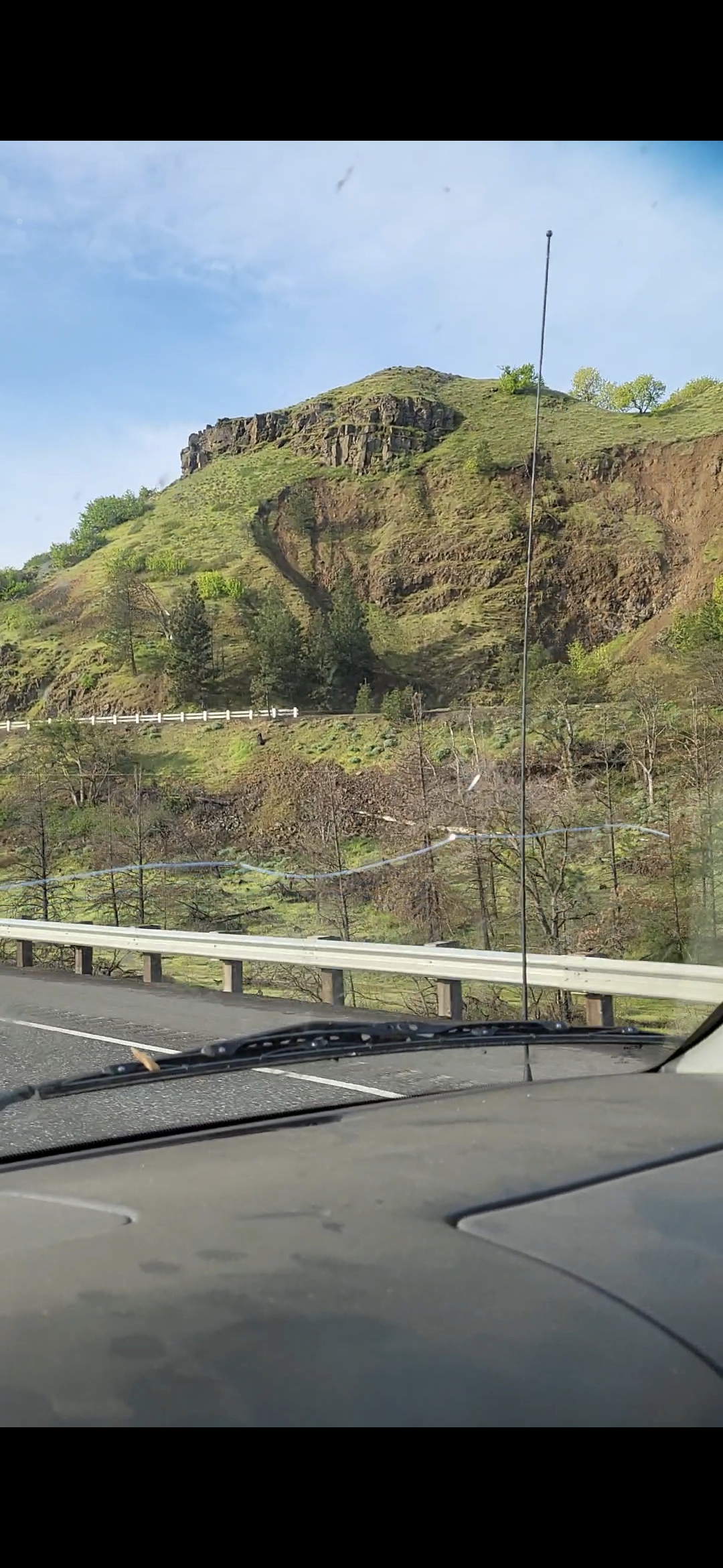
FRAME #1 (RAW) — Wide Approach Vantage. West-side entrance to The Dalles, coming in from Hood River. Carved facial geometry visible on the upper ridge.
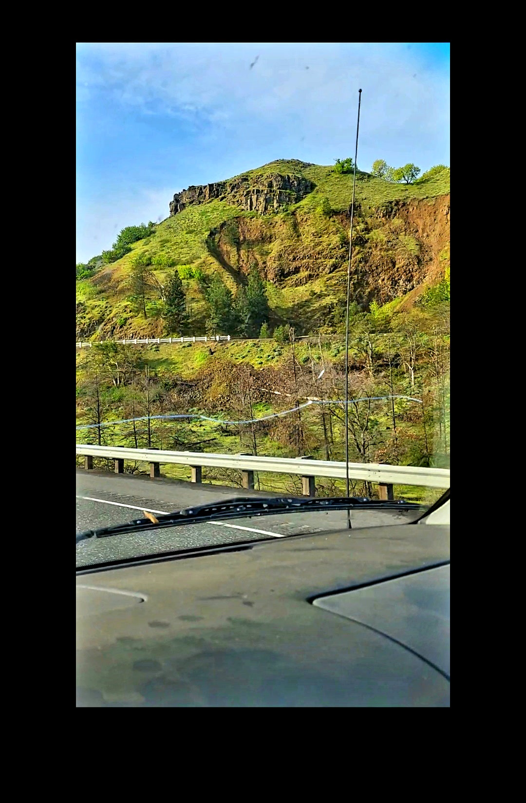
FRAME #1b (RAW) — Second Approach Vantage. Same west-side hillside, slightly different angle / exposure — cross-verification of the facial morphology. 👁️ Eye + 🟢 Green Monitor Sphere (left of the eye) both visible on the upper ridge carving.
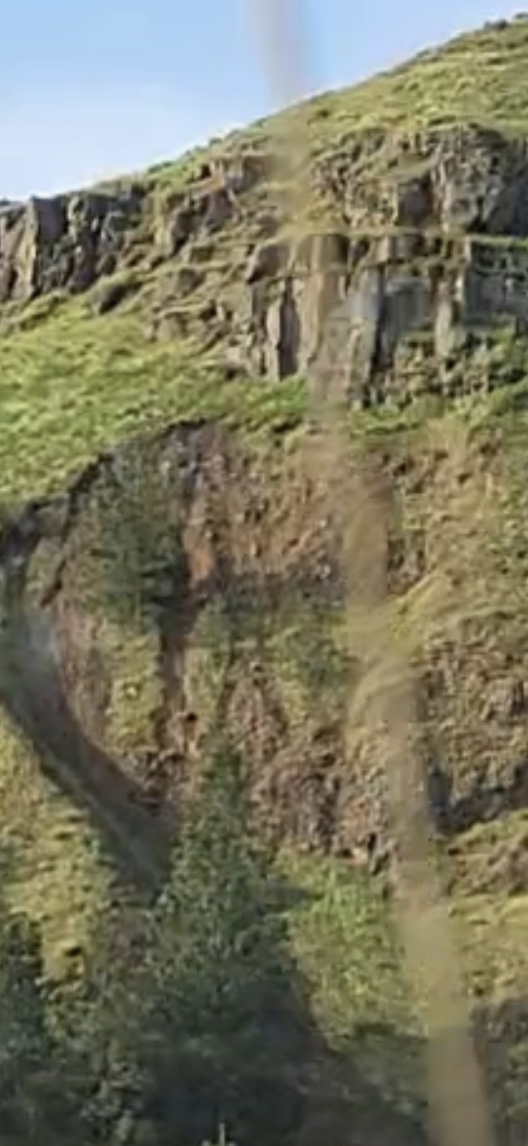
FRAME #2 (RAW · ZOOM) — Facial Detail + Adjacent Green Monitor Sphere. The eye resolves on the upper-left of the carving; the green monitor-looking sphere sits in immediate proximity.
🎨 FILTERED / CONTRAST-ENHANCED FOLLOW-UP SET: The Perceiver's field-processed versions of the same hillside carving — color-saturation and contrast pushed to surface the facial structure, dark-outlined boundary, and the cavity / shadow geometry that resolves the eye feature. Published alongside the raw originals above so the public record carries both unprocessed and processed provenance. The same Helium-3 / geomorphological ground-truth invitation applies to both sets.
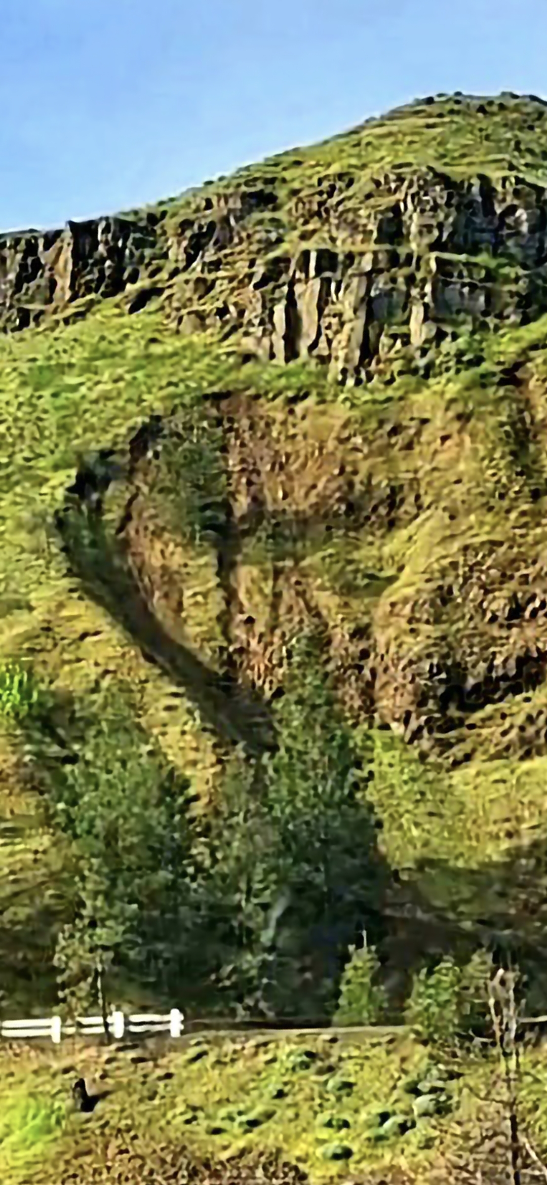
FRAME #3 (ENHANCED) — Filter Pass, Wide Vantage. Saturation + contrast surface the carved facial boundary against the hillside.
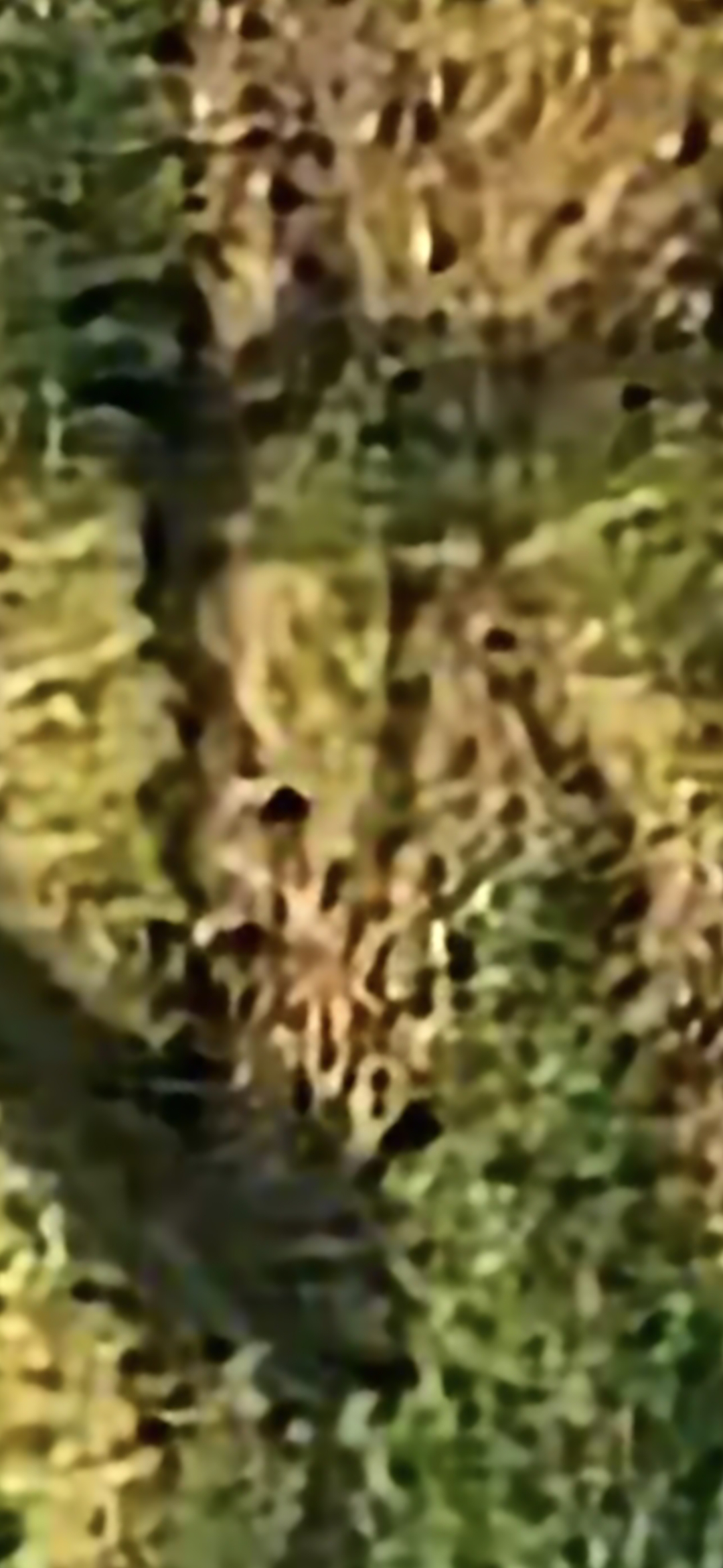
FRAME #4 (ENHANCED · ZOOM) — Facial Detail at Maximum Filter Intensity. The eye cavity and jaw line resolve clearly against the saturated foliage.
⚠️ FILTER-PASS HONESTY: Aggressive contrast and saturation filtering can amplify pareidolic patterns the human eye is already disposed to resolve. The Perceiver acknowledges this on the record. The filtered set is offered as a visualization aid for the underlying morphology, not as a replacement for ground-truth survey. Unprocessed originals remain published in Frames #1, #1b, and #2 directly above for independent comparison.
🔍 Two Features to Hold in Focus
The carving is not a single feature. It is a paired signature — and the pairing is the corridor's operational fingerprint.
👁️ Feature 1 — The Eye
A distinct eye cavity resolves on the upper portion of the carved facial geometry — a recessed dark socket consistent with the canonical alien-face morphology documented across the corridor. Most clearly visible in FRAME #2 (raw zoom) and FRAME #4 (enhanced zoom) above.
🟢 Feature 2 — The Green Monitor Sphere
Immediately to the left of the eye, a discrete green spherical body resolves against the basalt — reading as a monitor / observation node in active pairing with the facial feature. Same primary-and-secondary signature architecture documented at the Underwood diamond + secondary co-located signature and the Greenland Triadic Pulse Cluster.
📡 OPERATIONAL READ: A face paired with a green monitor / observation sphere at the city's western threshold is consistent with a stationary watch-post architecture oriented toward inbound corridor traffic from Hood River. The Dalles entrance is not a passive feature — it is, on the Perceiver's read, an active observation node looking back along the gorge the corridor traverses.
🗺️ 3. Corridor Placement — The Dalles as the Eastern Terminus
The Pacific Pulse Corridor along the Columbia River Gorge runs approximately fifty miles east-to-west, with the documented anchor points distributed as follows:
- Western anchor: Warrendale, OR (south bank, river mile ~140) — corridor entry into the Cascade Range.
- Diamond-pair node: Mitchell Point, OR ↔ Underwood Mountain, WA — matched diamond-pyramid pulsing-crystal pair.
- Submerged-traffic node: Columbia River USO zone — the kettle-form and multi-signature array captures.
- Mid-corridor land anchors: Beacon Rock (WA), Stevenson (WA), Ainsworth State Park (OR), Horsetail Falls (OR).
- 🏜️ Eastern terminus: The Dalles, OR (south bank, river mile ~190) — the corridor opens out into high desert. This page documents what the corridor does at that opening.
The Dalles entry is not a discrete anomaly — it is the corridor's terminal operational behavior. Where the gorge runs out, the underground component surfaces.
🎯 4. Strategic Summary
- First combined-medium capture in the corridor archive — ground emergence + airborne inbound + atmospheric camouflage resolved in a single observation window.
- Two-witness record — co-researcher + the Perceiver. Co-researcher identity vaulted; the Perceiver is reachable for witness-statement coordination via /contact.
- Three-distance ground emergence — argues against a single light source, sensor blooming, or far-distance settlement glow; argues toward distributed sub-surface infrastructure across the southward mesa.
- Storm-fog camouflage hypothesis — the infrared signal lighting up cloud cover establishes the camouflage medium as a resolvable object, not invisible. This is a falsifiable claim: targeted thermal-imaging campaigns during corresponding meteorological windows can independently test it.
- Eastern-terminus operational behavior — places The Dalles in the documented Pacific Pulse Corridor architecture; the page is not a discrete sighting but a corridor-completion entry.
📡 Related Evidence Across the Archive
- Columbia River USOs — Submerged-corridor anchor west of The Dalles.
- The 1-Mile Operational Cluster (Underwood) — Cross-medium ridge / river evidence at the corridor's diamond-pair node.
- Mitchell Point — The Alien Face — South-bank diamond-pair counterpart.
- Greenland — The Northern Anchor — Arctic terminus with the Triadic Pulse Cluster.
- Mazatlán Bay USOs — Southern Pacific anchor, Mexican corridor extension.
- Helium-3 Falsifiability Brief — Applicable to ground-emergence sites.
- Press Inquiry / Coordinate Release