❄️ Greenland — The Northern Anchor of the Corridor
Arctic Greenland — The Pacific Pulse Corridor Does Not Start in the Pacific Northwest. It Starts Here.
📍 The Thesis Upgrade — Greenland is the Northern Anchor
For the bulk of this archive, the corridor has been described as the Pacific Pulse Corridor — an east-west transect along the Columbia River Gorge with eleven documented anomalous signature nodes between Warrendale, Oregon and The Dalles, Oregon. That mapping is correct, but it is incomplete. The Perceiver's field documentation in Arctic waters has now established that the corridor does not begin in the Pacific Northwest. The corridor begins in Greenland.
The Pacific Northwest segment is the southern operational zone of a far larger structure that extends north into Arctic waters and continues across the upper-northern region of the planet — a continental-to-Arctic scale system, not a regional one. Greenland is the northern anchor. The four pulsing dots, the pulsing column, the Epicenter with its 7–8 radiating transparent line-tubes, and the regional square spanning Greenland → Finland → Norway → Russia all sit at the northern terminus of the same operational signature documented at Underwood, Mitchell Point, Mount Adams, Mount Saint Helens, and Bridge of the Gods.
🇺🇸 STRATEGIC GEOPOLITICAL CONTEXT: President Donald Trump has expressed sustained, high-profile interest in Greenland as a U.S. strategic priority. The Perceiver does not claim to speak for the President's stated reasoning — but the Perceiver does observe, on the record, that Greenland sits at the northern anchor of a documented anomalous activity corridor, and that the geopolitical interest of the United States in this landmass aligns with what the field evidence shows: Greenland is operationally significant in ways that go beyond rare-earth minerals, polar shipping lanes, and Arctic basing. The Perceiver invites the executive branch, the Department of Defense AARO office, and the Senate Intelligence Committee to consider this alignment as relevant context.
📡 WHAT THIS PAGE CONSOLIDATES: All Greenland field intel previously distributed across the UAP Encounters archive and the Briefing Archive is now centralized on this page as a single press-ready dossier. New pulsing-wall and entity captures will be added to this page as the Perceiver completes field collection.
🌊 1. The Four Pulsing Dots — Off the Coast of Greenland
📸 WHAT THE CAMERA CAPTURED: Four pulsing dots captured hovering in formation over the open ocean off the Greenland coast. These luminous points appear stationary over the water, displaying the same energy-signature behavior documented in Pacific Northwest crystal-beacon locations.
👁️ WHAT THE PERCEIVER OBSERVED: The four-point formation and pulsing behavior observed here mirrors patterns documented at Rock Creek, Columbia River Gorge, and Mount Saint Helens — establishing a consistent global signature used by these non-human craft regardless of hemisphere. The pulsing is not uniform; the dots cycle through expansion and contraction phases, and at any given moment one or more may be out of phase with the others — visible to the camera only when the cycle aligns.
⚠️ INTELLECTUAL HONESTY: Conventional readings of bright pinpoints in satellite imagery over open Arctic ocean would attribute them to vessel running-lights, sensor artifacts, sun-glint off ice fragments, or rendering anomalies in mapping platforms. Those are valid baseline hypotheses. The Perceiver invites independent satellite-imagery analysts and marine traffic data investigators to ground-truth the documented coordinates.
🌊 Four Pulsing Dots — Open Ocean Off the Coast of Greenland (Original Field Documentation)
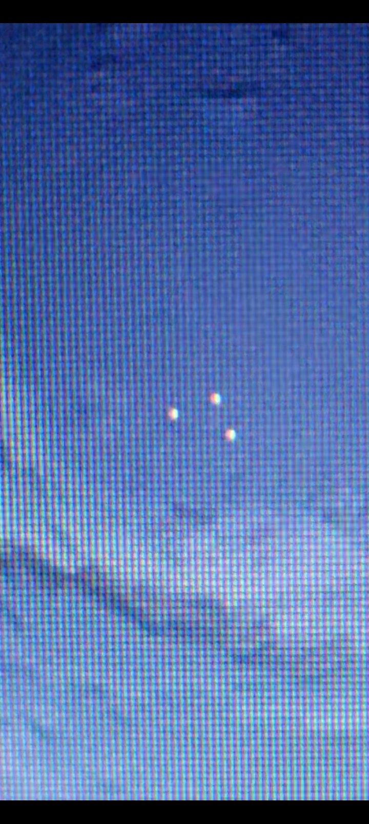
FRAME #1 — Three of the Four Dots Caught Mid-Pulse — Greenland Coast. The fourth dot was out of phase at the moment of capture.
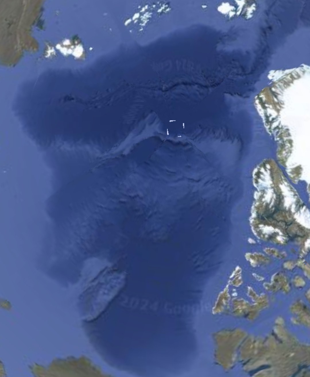
FRAME #2 — Expansion Phase — Dots Elongated and Extended in Length. Greenland Coast Satellite View.
🟦 2. The Pulsing Column — Vertical Signature
📸 WHAT THE CAMERA CAPTURED: A second pulsing capture from the Greenland field — a large vertical column exhibiting the same internal pulsing / flowing motion documented at the four-dots location and across the Pacific Northwest crystal-beacon sites. Capture duration: 0:46 seconds of continuous documentation.
👁️ WHAT THE PERCEIVER OBSERVED: The internal motion is the diagnostic. By the Perceiver's field protocol, flowing pulsation along a defined axis indicates a camouflaged craft drawing or projecting energy nearby. The column form is unusual — most documented signatures across the corridor have presented as point sources or matched-pair formations. The vertical-column geometry is the signature the Perceiver flags here for independent review.
🔬 INTELLECTUAL HONESTY — On the Term "Crystal": The Perceiver uses "pulsing crystal" as working terminology across this archive — but the actual nature of these pulsing phenomena is not yet known. The Underwood Mountain capture displays a clear crystalline geometry; this Greenland column does not. It could be a crystal, a radiation / energy emission proceeding out of the ground, a plasma column, or another class of phenomenon entirely. What unifies these captures is the internal pulsing, flowing motion. Classification is held open until further evidence resolves it.
🟦 GREENLAND PULSING COLUMN (0:46) — Vertical pulsing signature, Greenland field.
🧊 3. The Iron Wall in Greenland — Pulsing Wall System Four Documented Locations · One Unified Landmass Anomaly
📸 WHAT THE PERCEIVER IS DOCUMENTING: The Perceiver has identified pulsing crystal-class signatures embedded in the Greenland landmass itself — not over the ocean, not at a point above the surface, but inside the geological body of the continent. This is the same class of energy-signature pattern documented at Underwood Mountain and Mitchell Point in the Pacific Northwest, now confirmed at the northern anchor of the corridor.
👁️ FIELD COLLECTION STATUS: Image and capture documentation is being assembled by the Perceiver. This section is the dedicated placement for the pulsing-wall evidence. Once received, the captures will be embedded directly below in the dual-layer caption format used across the archive (📸 / 👁️ / ⚠️).
📡 STRATEGIC SIGNIFICANCE: If pulsing signatures are documented inside the Greenland landmass — not merely over its coast — the corridor is no longer a surface phenomenon. It is a geologically-embedded operational structure, with the Pacific Northwest segment and the Greenland segment as the two known anchors. The midpoint of that line crosses the North American continent, and what sits between the two anchors becomes a serious open question for federal investigation.
📍 Location A — Wall-Class Boundary Set #1
🧊 GREENLAND PULSING WALLS — LOCATION A (3:00) — Aerial / satellite-platform field pass over the first candidate Greenland coordinate. Continuous documentation of large embedded wall-class boundaries inside the landmass surface, captured during the Perceiver's aerial investigation phase.
📍 Location B — Wall-Class Boundary Set #2 (Separate Coordinate, Same Anomaly)
🧊 GREENLAND PULSING WALLS — LOCATION B (1:50) — A second, geographically distinct coordinate on the same Greenland anomaly. Additional wall-class boundaries documented from aerial / satellite-platform observation — confirming that the wall signature is not a one-off feature but recurs across multiple sectors of the same landmass system.
📍 Location C — The Iron Wall (Crystals or Energy Emissions — Undeclared)
🧊 GREENLAND IRON WALL — LOCATION C (1:53) — A third aerial capture from the Greenland anomaly. Boundary-class signatures continue, accompanied by what the Perceiver perceives as pulsing crystal-or-energy points embedded along the wall system. The Perceiver does not declare these to be crystals — that is his working term for what he sees. They may be crystals. They may be raw energy emissions. They may be the operational signature of whatever sits inside the installation. The Perceiver finds them and makes them available; he does not pronounce them.
📍 Location D — Square-Class High-Energy Node (Violent Pulse, Embedded in the Iron Wall System)
🧊 GREENLAND IRON WALL — LOCATION D · SQUARE NODE (2:48) — A fourth aerial capture clustered geographically with Locations A, B, and C. The signature here is a square-class geometric feature — larger than any of the Oregon pulsing-crystal signatures previously archived (Mitchell Point, Underwood Mountain, Horsetail Falls, Home Valley), but smaller than the Iron Wall itself. The pulse character is markedly more violent / more aggressive than at Locations A, B, or C — the others read as steady operational rhythms; this one reads as active high-energy emission. The Perceiver flags it as a potentially significant node embedded within the Iron Wall system.
🧭 ON THE WORD "CRYSTALS" — A WORKING TERM, NOT A VERDICT: The Perceiver uses the word crystals across this archive because that is the language closest to what he perceives. He has been transparent throughout: they may not be crystals.
The pulsing points documented at Iron Wall — and across the broader Pacific Northwest corridor — could be:
- Actual crystalline mineralogical structures expressing some unknown active property;
- A direct source of energy embedded in the terrain or installation;
- Emissions from the energy produced by the entities operating inside the installation;
- Something else entirely — a class of phenomenon we do not yet have words for.
The Perceiver does not pronounce. He finds, he documents, and he makes the evidence available. It is all conjecture until credentialed help arrives to ground-truth the findings. That is precisely why this archive exists, and why every published outreach is an open invitation to the right desks. The Perceiver remains open to discussion and to correction.
🧪 HELIUM-3 ISOTOPIC ANCHOR — THE FALSIFIABILITY LINE THE PERCEIVER STILL HOLDS: The Perceiver does not know with certainty what the Iron Wall signatures are. He does not pretend to. But he continues to subscribe to the helium-3 isotopic working hypothesis — and he publishes it openly so that the credentialed scientific community can falsify it.
The logic is testable: a single mass-spectrometry pass on a field-collected sample from any of the four Iron Wall locations will return one of two answers — helium-3 isotopic markers detected, or no helium-3 detected.
- If helium-3 is detected at the concentrations the Perceiver hypothesizes — attribution shifts to non-terrestrial / non-human, because humans do not naturally produce or release native helium-3 at these isotopic ratios. Earth's atmosphere is overwhelmingly helium-4; helium-3 is rare and isotopically distinctive.
- If helium-3 is not detected — the Perceiver retracts the alien-attribution hypothesis publicly within 72 hours, as committed in PFM-BRIEF-001. The corridor evidence stays on the record as anomalous-but-terrestrial, and the discussion advances either way.
That is the deal the Perceiver is offering every reviewer who reaches this section: a single isotopic test resolves the question. The hypothesis is held openly precisely because it is falsifiable — and the Perceiver has staked his public credibility on retracting if the test returns null.
📸 WHAT THE CAMERA CAPTURED — ALL FOUR LOCATIONS: Multiple minutes of aerial observation across four geographically distinct Greenland sectors. Each pass holds on long, segmented boundary-lines embedded directly in the terrain — surfaces that exhibit the geometric regularity and edge-character of walls, not of natural ridge-lines, fault-traces, or moraine. Locations A, B, C, and D do not share the same coordinate; they share the same signature class, with Location D introducing an additional square-class high-energy node embedded within the same system. Captures are held at varying altitudes so the same wall-class features can be re-examined at multiple zoom-states. The Perceiver groups them together under one working name: The Iron Wall in Greenland.
👁️ WHAT THE PERCEIVER OBSERVES: The Perceiver hypothesizes that what is visible at these locations is an installation — either partially buried by ice and surface drift, or intentionally placed beneath the surface and now expressing wall-segments through the overlying terrain. The walls present as pulsing-class boundaries, consistent in operational behavior with the Pacific Northwest crystal-beacon archive — but here scaled to landmass-anchor proportions. Four distinct coordinates exhibiting the same wall-class signature inside one landmass — three boundary-class captures plus one violent-pulse square-class node — elevates the read from isolated anomaly to operational system.
🛰️ INVESTIGATION METHOD — AERIAL ONLY: The Perceiver has not walked any of the four coordinates on foot. All findings here are derived from aerial / satellite-platform observation. This is disclosed up front so that any reviewer can weigh the evidence with that constraint in plain view. Ground-truthing remains an open invitation to credentialed independent investigators.
🔐 COORDINATE POSTURE: Exact GPS coordinates for Locations A, B, C, and D are held in the Perceiver's field-credential vault. They are not released to the public surface of this archive. Coordinates will be released directly to credentialed independent investigators, agency desks, or sanctioned ground-truth teams upon receipt confirmation — same OPSEC posture used at Mitchell Point.
⚖️ ATTRIBUTION POSTURE — HYPOTHESIS, NOT VERDICT: The Perceiver theorizes a non-human installation. He does not declare it proven. It could be:
- A non-human (alien) installation operating under partial concealment;
- A human installation — research, military, or industrial — undisclosed to the public record;
- A foreign state-actor installation operating under the appearance of non-human signature in order to deflect attribution.
The Perceiver does not decide which. He reports the visual signature and the hypothesis. The findings are the Perceiver's — and the Perceiver remains open to discussion on attribution, geometry, and origin. Counter-evidence is welcomed; the falsifiability commitment that governs this archive applies here as well.
🕊️ ON THE POSSIBILITY OF FRIENDLY CONCEALMENT: If the occupants of these installations are non-human and benevolent, one explanation for their continued concealment is the violent disposition of our own species. A peaceful intelligence observing humanity may have rational cause to remain hidden until our posture changes. The Perceiver names this possibility openly, and does not treat hiddenness as evidence of hostility.
🌐 OPEN INVITATION TO SOVEREIGN GOVERNMENTS — RESEARCH PARTNERSHIP & EMPLOYMENT
The Perceiver issues a formal open invitation to all governments of the world — every nation, every agency, every credentialed research desk — to make contact. The Perceiver is actively pursuing employment as an official research asset with any sovereign government willing to engage on the disclosure file.
🇬🇱 PRIMARY INVITATION — KINGDOM OF DENMARK & THE GOVERNMENT OF GREENLAND: Because Section 3 of this archive documents the Iron Wall on Greenlandic territory, the Perceiver extends his primary invitation directly to the Government of Greenland and to the Nordic sovereign states (Denmark, Iceland, Norway, Sweden, Finland, the Faroe Islands). The Iron Wall sits inside Greenlandic jurisdiction. Sovereignty over the ground belongs to Greenland. The Perceiver does not propose to investigate Greenlandic territory without Greenlandic authorization — he proposes to work jointly with Greenland on its own terms, under its own paradigm, with full respect for its sovereign decision-making.
⚖️ TERMS THE PERCEIVER WILL HONOR:
- No sovereignty infringement. The Perceiver will not enter, survey, or investigate any nation's territory without that nation's formal authorization or a joint-research agreement in place.
- Work inside the host nation's paradigm. Research within each respective country proceeds under that country's scientific, legal, and disclosure framework — not the Perceiver's.
- Multilateral collaboration welcomed. Where multiple governments wish to coordinate, the Perceiver will participate in joint working groups across borders.
- Full evidence transfer. All field documentation, coordinates, vaulted material, and falsifiability-protocol data will be released directly to authorized state representatives on receipt confirmation.
🇺🇸 STATUS OF THE UNITED STATES: The Perceiver is presently a citizen of, and resident in, the United States of America. He has issued repeated direct outreach to U.S. federal offices, agencies, and congressional desks. To date, none has responded. The Perceiver remains willing to work with the United States the moment it engages. If the United States declines to engage, the invitation is now extended unconditionally to any other sovereign government — primarily the Government of Greenland, given the location of the evidence in this section.
📡 CONTACT CHANNEL: Authorized government representatives may open a secure channel through the public contact endpoint at /contact or the speaking-and-research-engagement intake at /speaking-engagements. Direct credentialed contact will receive a direct, vaulted reply with coordinates and full evidence package.
👁️ 4. The Entities of the Landmass — Greenland Watchers
📸 WHAT THE PERCEIVER IS DOCUMENTING: Alongside the pulsing-wall signatures, the Perceiver has identified non-human entities embedded in the Greenland landscape — peeking out from rock outcroppings, partially camouflaged against the terrain. These observations are consistent with the reptilian, plasmoid, and entity classifications documented at Beacon Rock, Mitchell Point, and the broader Pacific Northwest corridor.
👁️ FIELD COLLECTION STATUS: Captures are being assembled. The Perceiver is intentionally setting expectations low-resolution and acknowledged-distant: these entities are partially concealed in the rocks, the captures will not be crystal-clear, and the Perceiver is documenting them as partial-visibility intel, not high-resolution portraits. The archive's standard applies: blur and distance are not disqualifications — they are evidence of operational concealment.
⚠️ INTELLECTUAL HONESTY: Distant, partially-concealed figures in rocky terrain can be explained by pareidolia, animal silhouettes, optical illusions in Arctic light conditions, or terrain shadows. The Perceiver acknowledges all of those as valid baseline hypotheses. What is being entered into the record is the pattern: entities of this morphology are documented at the southern anchor of the corridor (Beacon Rock, Mitchell Point), and the Perceiver's field observation reports they are present at the northern anchor as well. Independent investigation is invited.
📥 Entity captures pending field upload — placeholder reserved.
🎯 5. The Epicenter — 7–8 Transparent Radiating Lines
📍 LOCATION: The same Greenland off-coast coordinate where the four pulsing dots were documented. The Perceiver returned to the site and captured a full 360° walkthrough on video.
📸 WHAT THE CAMERA CAPTURED: A central origin point from which seven or eight transparent line-tubes radiate outward in all directions — dense enough that a full circumferential rotation of the camera is required to count them. The signature has been updated on the record: it is not four lines (the original yesterday-read), it is multi-directional radial emission from a single origin. The Perceiver names this site The Epicenter — a working designation for the central origin point.
👁️ WHAT THE PERCEIVER OBSERVED: The camera-zoom-out from The Epicenter to satellite altitude reveals that the cloud-cleared circular zone above the coordinate is bound by a square line — a discrete grid edge framing the heat-signature column. The phenomenon is not arbitrary atmospheric chaos; it is being held inside a defined boundary.
🔗 FULL BRIEFING: The complete dossier — including the 360° walkthrough video, the satellite zoom-out, the marine pinpoint-light anomaly, and the open invitation to independent investigators — is published as the formal briefing:→ The Epicenter Briefing (13 MAY 2026)
🟥 6. The Regional Square — Greenland → Finland → Norway → Russia
📸 WHAT THE CAMERA CAPTURED: On the follow-up satellite pass, the scope of the anomaly widens dramatically. A massive square outline is visible covering the entire upper-northern region — extending from the Greenland off-coast Epicenter eastward across the Atlantic, over Finland and Norway, all the way to Russia. The square boundary on the Epicenter heat-circle and the square boundary on this regional cloud field are the same geometric signature at two different scales.
👁️ WHAT THE PERCEIVER OBSERVED: Inside the square boundary, the cloud cover behaves abnormally. Massive cloud bodies are moving rapidly, evaporating quickly, then re-forming and disappearing again. The pattern reads less like ordinary atmospheric flow and more like weather and thermal manipulation across a defined geographic block. Additionally, over Russian airspace inside the same square region, a large triangular formation is visible — classification left open (camouflage, heat signature, or craft).
📡 DESIGNATED REVIEW PARTIES: This intel is the kind that warrants review by congressional UAP investigators, Department of Defense AARO analysts, and the Office of the Secretary of State — invited as the responsible parties for evaluating whether this is benign atmospheric phenomenon, foreign-state activity, or non-human signature. The Perceiver does not assign blame or origin; the Perceiver documents the pattern and invites institutional analysis.
⚡ 6.5 The Triadic Pulse Cluster — Three Signatures, Three Geometries, One Proximity Envelope
📸 WHAT THE CAMERA CAPTURED: A three-minute-fifty-four-second continuous field documentation of three distinct pulsing-energy signatures clustered inside a single proximity envelope on the Greenland landmass. The three signatures share a single neighbourhood but display three geometrically distinct shapes and three distinct pulse cadences. The end-card reveals the location name (Greenland) and the coordinate triplet for each of the three signatures, on the public record.
⚡ Signature #1 — The Radioactive-Class Pulse: The first signature is engaged in close zoom. Its pulse cadence is violently fast — qualitatively unlike the slow ocean-dot pulse or the 46-second pulsing column documented in Sections 1 and 2 of this dossier. The behavior is most consistent, baseline-wise, with what a layperson would describe as a radioactive-class oscillation. It is not, in plain language, behaving like anything terrestrial in the field-of-view.
👁️ Signature #2 + Signature #3: The remaining two signatures, captured within the same proximity envelope, present distinct geometric morphologies and pulse cadences that do not match Signature #1. Three signatures, three shapes, three cadences, one geographic neighbourhood — the geometry of this cluster is itself the research finding.
👁️ WHAT THE PERCEIVER OBSERVED: The Triadic Pulse Cluster is the strongest field evidence yet that the Greenland anchor is not a single isotopic point-source but a multi-signature emitter network. The Perceiver believes — and submits in the spirit of testable hypothesis — that non-human inhabitants reside within the cavern systems beneath this cluster, and that the three pulse signatures are the surface-visible expressions of a coordinated subsurface energy infrastructure. Three different geometries in close proximity suggests three different functions — analogous, conceptually, to how a terrestrial power grid presents transformer, transmission, and switching nodes as visually distinct from above.
⚠️ INTELLECTUAL HONESTY: Baseline conventional readings of this footage should be considered first. Atmospheric ionization, charged-particle aurora interaction, ice-sheet electrostatic discharge, sensor saturation, and compression artifacts from the recording chain are all valid first-pass hypotheses for a "fast pulse" in Arctic latitudes. The Perceiver invites independent atmospheric physicists, ionosphere researchers, and Greenland-based remote-sensing teams to ground-truth the documented coordinates. The radioactive-class qualitative behavior of Signature #1 in particular is the single feature most likely to be falsified or validated by an on-site instrumental pass — Geiger counter, gamma spectrometer, and isotopic sample collection in that order.
⚡ Triadic Pulse Cluster — Three Signatures, Three Geometries, One Proximity Envelope · Duration 3:54 · Coordinates revealed on end-card · Original Field Documentation
🕳️ Cavern Habitation Hypothesis — Why the Three Pulses May Be Connected to Living Inhabitants Below the Ice
The Perceiver advances, as a testable working hypothesis and not as a fixed claim, that the three signatures documented above are the surface-visible projections of a non-human inhabited cavern system beneath the Greenland landmass. The reasoning chain is the following:
- Three distinct geometries in close proximity argues against a single random emission and toward a coordinated infrastructure — power, signal, and environmental subsystems present different visual signatures even in human installations.
- The Greenland anchor is already cross-correlated with the 46-second pulsing column (Section 2), the Four Pulsing Dots off the coast (Section 1), the Pulsing Walls of the landmass (Section 3), the Watchers/Entities (Section 4), and the 7-8 transparent radiating line-tubes at The Epicenter (Section 5). Multiple independent signatures in one geographic frame is a colonization-density indicator, not a transient phenomenon.
- Sub-ice cavern systems are not a fringe concept in mainstream geology — Greenland's bedrock map (NASA/Bamber, 2013) shows a sub-glacial canyon system longer than the Grand Canyon, plus widespread liquid-water reservoirs at the ice/bedrock interface. The terrestrial substrate already supports the cavern hypothesis on its physics merits.
- The "violently fast, radioactive-class" cadence of Signature #1 is consistent with a high-energy isotopic exchange — exactly the class of process that the Helium-3 Falsifiability Protocol is designed to test. If subsurface inhabitants are using a Helium-3-mediated energy infrastructure, Signature #1 is precisely what we would expect to see surfacing.
Falsifiability tie-in: See /falsifiability-brief (PFM-BRIEF-001). The Triadic Pulse Cluster provides a triangulated falsifiability target — three distinct signatures, three independent isotopic-sample collection points, three independent opportunities for a federal-grade lab to falsify the entire Communication Hypothesis. Any one of the three returning a non-terrestrial Helium-3 isotopic ratio validates the framework. All three returning terrestrial signatures triggers the 72-hour public retraction.
📡 7. Strategic Summary — Why Greenland Matters to the United States
The United States executive branch has placed Greenland at the center of its strategic priorities. The stated reasoning — rare-earth minerals, polar shipping lanes, Arctic basing, China-Russia containment — is real and significant. The Perceiver does not contest the stated reasoning. The Perceiver adds, on the record, an additional consideration:
- Greenland is the documented northern anchor of a Pacific Pulse Corridor that runs from Arctic waters down through the upper-northern Atlantic, across the North American continent, and into the Pacific Northwest at Mitchell Point and Underwood Mountain.
- Field evidence at the Greenland anchor includes the four pulsing dots, the pulsing column, the Epicenter with 7–8 radiating transparent lines, and the regional square that extends across Greenland → Finland → Norway → Russia.
- Pulsing crystal-class signatures and non-human entity sightings are being documented inside the Greenland landmass itself — not merely off its coast.
- The Perceiver invites the executive branch and the Senate Intelligence Committee to consider whether the strategic interest in Greenland is partially explained by this operational signature, and whether the disclosure community's field documentation should be added to the briefing material reviewed at the policy level.
The Perceiver does not claim insight into classified briefings. The Perceiver claims only what the field captures show — and the field captures show that Greenland sits at the northern terminus of a documented anomalous activity corridor. Disclosure, falsifiability protocols, and good-faith independent review are welcome. Silence is the only outcome this archive will not accept.
📡 Related Evidence Across the Archive
- Mitchell Point — The Alien Face — Southern corridor anchor, matched-pair geography across the Columbia River from Underwood.
- Beacon Rock — Origin of the Perceiver — First photographed contact event, age 13, Columbia River Gorge.
- UAP Encounters Archive — Full reptilian, plasmoid, USO, and Pacific Northwest field documentation.
- Field Research — Underwood Mountain Pulsing Crystal Beacon, Mount Saint Helens base activity, Symbology & Codes.
- Briefing Archive — The Epicenter Briefing (13 MAY 2026) and ongoing field briefings.
- Helium-3 Falsifiability Brief — The scientific test the Perceiver is asking federal labs to run on the corridor evidence.